 |
 |
Airborne Geophysical SurveysCutting edge technology is key. Modern exploration techniques, including High Resolution Airborne Magnetics surveys, permits Leland to rapidly focus resources on high potential mineral targets. Surveys are flown at 100 metre line spacing and at a mean terrain clearance of 20 metres. 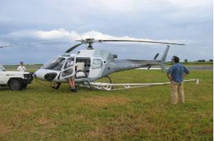 To date, three airborne surveys have been flown, covering over 17,000 km² of our ground as outlined in the map below. The precision of this technology permits us to not only locate magnetic bodies as small as 1 Ha (100 metres in diameter) but to drill them immediately should we consider them to be kimberlites. This permits Leland to “skip” the time consuming and costly stage of ground sampling and, at least initially, kimberlite indicator mineral analysis. Similarly, gold and base metal deposits tend to be found in associations of structural elements which can be discerned with a great degree of confidence from this same geophysical data. During the surveys, radiometric data is also collected which effectively "maps out" the granite gneiss background under the generally thin overburden, indicating where other rock types exist. By way of example, the Ikungu Survey (shown below) has assisted Leland in identifying 66 kimberlite anomalies or targets which have been subdivided into first, second and third order priorities for follow up work. 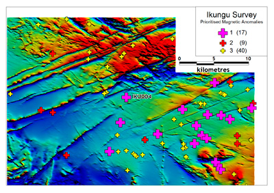 A close up of the Loya 1 Survey data shows the level of resolution and effectiveness of this technique – the two anomalies, now confirmed kimberlites, are readily apparent. Loya 1 was bulk sampled earlier in 2008. Click here to read more about bulk sampling. 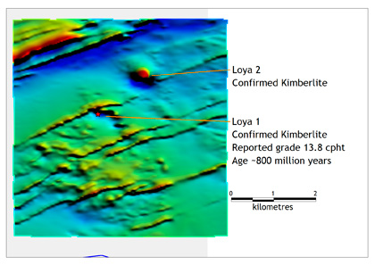 Site Map | Contact Us | Terms & Conditions
All Content Copyright © Leland Diamonds Limited 2007
|
  |